Santiago Insua Fernandez provides some details on the siting
of the stations for the two Spanish chains.
"The project to provide Decca Navigator coverage in Spain started in
October 1951 when an engineer named Carlos Alcón Sanz started to
work on the Northwest chain design. He worked for the Navigation Aids Department
inside the Ministry of Public Works. During the initial design, the stations
were to be located as follows:
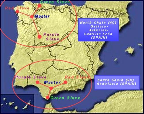
Master: Puebla de Sanabria (Zamora - Castilla y Leon) - http://goo.gl/maps/7HZJ
Red: Cabo Silleiro (Pontevedra - Galicia) - http://goo.gl/maps/r2hz
Green: Ribadesella (Asturias) - http://goo.gl/maps/9oPF
Purple: Alba de Tormes (Salamanca - Castilla y Leon) - http://goo.gl/maps/uNqo
Between 1951 and 1953 the South chain was also proposed by Carlos Alcón
Sanz, with the stations located at:
Master: Utrera (Sevilla - Andalucia) - http://goo.gl/maps/46tF
Red: Santa fe de Granada (Granada - Andalucia) - http://goo.gl/maps/GdRd
Green: Arcila (Morocco) - http://goo.gl/maps/P66Q
Purple: La Albuera (Badajoz - Extremadura) - http://goo.gl/maps/JgCx
As one can see. the initial locations are different from the final ones.
I don't know the exact reason for this but for example, in the South chain,
the independence of Morocco made impossible to maintain the location for
the green slave.
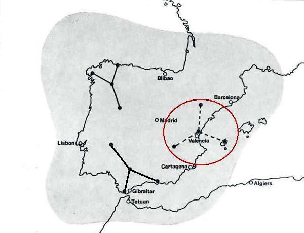
Another chain, projected by Mr. Alcon Sanz was the Mediterranean chain.
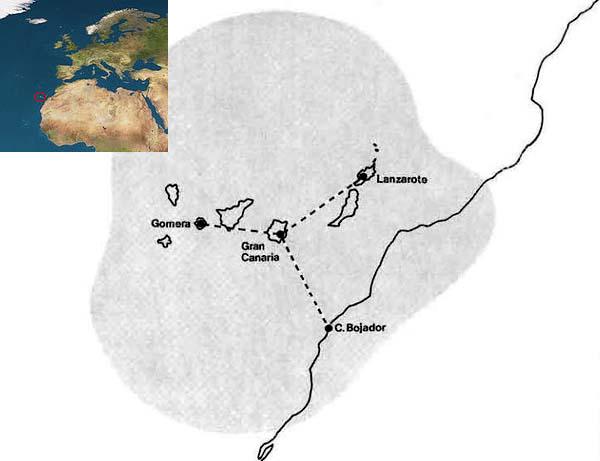
The initial project comprised four chains: North-West, South, Mediterranean
and Canary Islands.
The locations chosen for the Mediterranean chain were to be:
Master: Sagunto (Valencia) - http://goo.gl/maps/j5co
Red: Caspe (Zaragoza - Aragon) -
http://goo.gl/maps/1EfW
Green: Balazote (Albacete - Castilla la Mancha) - http://goo.gl/maps/8Oq4
Purple: Ibiza (Islas Baleares) - http://goo.gl/maps/eB49
Neither the Mediterranean of the Canary Islands chains were ever built.
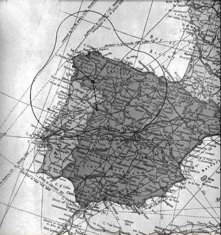
The project to build the North-west chain was approved on 28th July, 1956.
The locations were changed and officially assigned as:
Master: Manzaneda (Ourense - Galicia) - http://goo.gl/maps/SwPU
Manzaneda is the name of the mountain where the station was located.
The closest village is Trives.
Red: Noia (A Coruña - Galicia) - http://goo.gl/maps/N883
Moimenta is the name of the closest village, Lousame is the second
one and Noia is the main one. Officially Noia (in Galician) or Noya (in
Spanish) was used.
Green: Boal (Asturias) - http://goo.gl/maps/wQuJ
Purple: Vitigudino (Salamanca - Castilla y Leon) - http://goo.gl/maps/QUCd
"
