RAYDIST (from a wedding of the words radio and distance) is
a radio system for medium-range precision surveying in which the phases
of two continuous-wave signals are compared. It is based on the heterodyne
principle and uses low or medium frequencies.
The system was developed by the Hastings Instrument Company of Hampton
Virginia which was founded in 1944 by Charles and Mary Hastings when
Charles was only 30 years old. RAYDIST is first mentioned as a development
in the April 18, 1947 edition of the Cass City Chronicle (Cass City, Michigan).
RAYDIST first entered service in 1952 at the sea trials of the ocean liner
SS United States. It was used to measure her speed for purposes or calculating
fuel consumption.
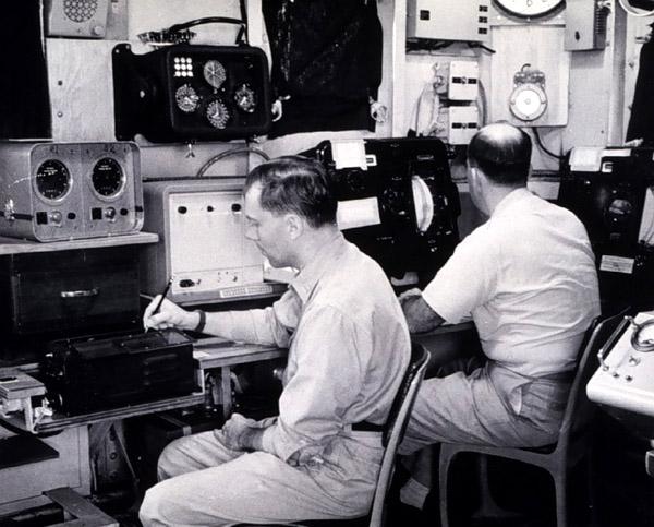
RAYDIST counts lanes of hyperbolic phase difference on a Brush 2 channel
medical recorder. Any number of receivers could be used at the same time
in one "net". Nets operated between 1670 KHz to near 1800 KHz. In a single
net, a center CW station transmitted around 1780 KHz, a Red station
on 1780.210 KHz and a Green station on 1780.370 KHz. In each net, these
offsets would be identical.
The user had to start from a known location. Then it was a matter of
counting green and red lanes. The 210 Hz and 370 Hz audio tones drove resolvers
which in turn ran gas meter heads. These could divide a lane into approximately
5,000 parts. Near shore accuracy could be in the one or two FOOT range!
The above describes type "N" (navigational) RAYDIST which permits
multiple users in the same net with an
accuracy about 50 to 100 ft at 50 miles offshore. There was a Distance
Measuring (DM ) version of RAYDIST as well.
DM RAYDIST was used to calibrate the Inertial Navigation Systems on
early nuclear submarines since there was no GPS in existence at the time.
DM with a transmitter on the user vehicle could accommodate only one user
at a time. DM used frequencies around 3 MHz and produced concentric lanes
of phase difference. Since the gas meter readout heads could resolve about
5,000 divisions in a single lane, its accuracy was about 2 or 3 feet at
300 miles from shore!
Tim Rogers, who worked at Hastings-Raydist from 1967 to 1975 as
a field engineer, provides additional details on some of the system variants.
"RAYDIST "DM" system was a hyperbolic system. The "DR" system
was a Direct Range system.
RAYDIST "T" system provided coverage for Chesapeake Bay, Maryland and
Virginia. It was a hyperbolic system comprised of about 6 shore stations".
Other RAYDIST variants mentioned on the web are type " E " and
"E.R".
Among its applications, it was to locate oil wells in the Gulf of Mexico.
Shell Oil was a good customer of RAYDIST and it was also part of
the Petroleum Helicopters operation in the mid 1960s. RAYDIST "nets" ran
from Texas to the west coast of Florida.
The system was never used in Europe but various web documents indicates
indicate useage in Tasmania, the Fly River in New Guinea, Brazil and Portuguese
Guinea. The system was evidently a forerunner of AERODIST which was an
aircraft based system made by a South African company. RAYDIST eventually
succumbed to history's scrap heap once satellite GPS became popular.