 |
 |
| Two views of the 84520E transmitter. Click on either image to enlarge. (Canada Science and Technology Museum photo and artifact # 1975.0040.001) | |
84520E LF RADIO RANAGE NAVIGATION TRANSMITTER
This low frequency transmitter type 84520E was part of Canada's Radio Range navigation system in 1934. The transmitter was manufactured to Departmenbt of Transmpoiort specifications by Cnadian Marconi. Serial number 320, shown below, was installed at Mount Joli P.Q.
Frequency range: The frequencies used by radio range stations in North America were essentially the same as those used by currently operating (but quickly disappearing) non-directional beacons (NDB's) used for aircraft navigation in Canada , That is, 200 to 430 KHz and 515 to -530 KHz
Power output: 400 watts
Mains power .115 VAC 50/60 Hz 25 amps
Dimensions: 30 in wide by 27 in deep. Height unknownThe low-frequency radio navagation range, also known as the four-course radio range or the A-N radio range, was the main navigation system used by aircraft for instrument flying in the 1930s and 1940s, until the advent of the VHF omnidirectional range (VOR), beginning in the late 1940s. It was used for en route navigation as well as instrument approaches and holds.
Based on a network of radio towers which transmitted directional radio signals, the radio range defined specific airways in the sky. Pilots navigated using low-frequency radio by listening to a stream of automated "A" and "N" Morse codes. For example, they would turn the aircraft to the right when hearing an "N" stream ("dah-dit, dah-dit, ..."), to the left when hearing an "A" stream ("di-dah, di-dah, ..."), and fly straight ahead while hearing a steady tone.The "on course" region, where the A and N audibly merged, was approximately 3 degrees wide, which translated into a course width of ±2.6 miles when 100 miles away from the station., Whether the "A" and "N" would be on a pilot's right or left would depend on whether the aircraft was inbound to or outbound from the radio range and would also depend upon which quadrant of the four course radio range the pilot was following
To illustrate, let's take ourselves back to 1960, we are boarding an aircraft in Vancouver and heading for Calgary. After takeoff the pilot would steer a course of 057 degrees away from the Vancouver range, identifying itself as "VR" on 266 KHZ. Since the pilot would be outbound from it, the "A" would be to the aircraft's left and "N" on the right. By the time our aircraft was approaching the town of Hope in the eastern Fraser Valley, it would be possible to pick up the Princeton radio range, further east on our route, transmitting "DC" on 326 KHz. Retuning our receiver to that frequency, we could "ride the beam" on a slightly different course of 058 degrees but because we are now inbound to the Princeton range, we have the "N" on our left and "A" on our right. After passing the Princeton range, we do a course correction to 065 degrees and continue heading east, still on the Princeton radio range, with the "A" on the left until we pick up the next range station.
Pilots had to verify that they were tuned to the correct range station frequency by comparing its Morse code identifier against the one published on their navigation charts. They would also verify they were flying towards or away from the station, by determining if the signal level (i.e. the audible tone volume) was getting stronger or weaker
As the VOR system was phased in around the world, low-frequency radio range was gradually phased out, mostly disappearing by the 1970s. There are no remaining operational facilities today. At its maximum deployment, there were nearly 400 stations exclusively using low frequency radio range in the U.S. alone.
|
|
| Two views of the 84520E transmitter. Click on either image to enlarge. (Canada Science and Technology Museum photo and artifact # 1975.0040.001) | |
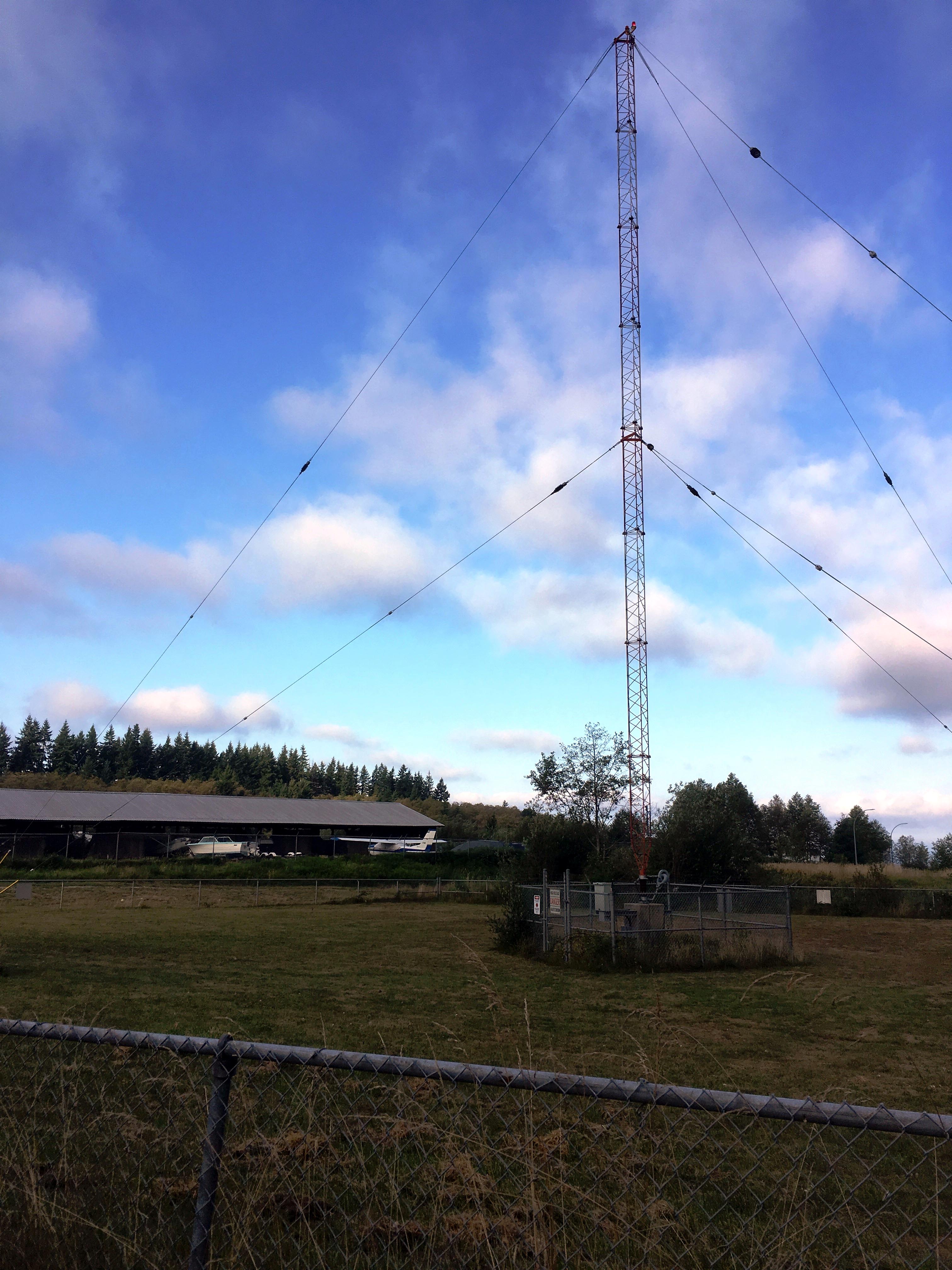 |
| This is the type of LF transmitting tower which was typically used in the radio range navigation network. Some locations used a "T" antenna instead of a tower. Click on image to enlarge. This particular installation is (non-directional beacon) station YPW located at Powell River B.C.. The purpose of each station in the network was to simply transmit the Morse letter 'A' or 'N'. (Photo by Tom Brent.) |
Contributors and Credits:
1) Canada Science and Technology Museum
https://ingeniumcanada.org/ingenium/collection-research/collection.php?fq=Communications%2CRadio%2CReceivers%20%26amp%3B%20transmitters&sort=id%20asc&limit=
100&q=*fq=Printing,Lock%20up/impositionfq=Motorized%20Ground%20Transportation,Cycles
2) https://en.wikipedia.org/wiki/Low-frequency_radio_range
3) Tom Brent
Dec 28/20